Virtual building
We digitalize your infrastructure and add intelligence


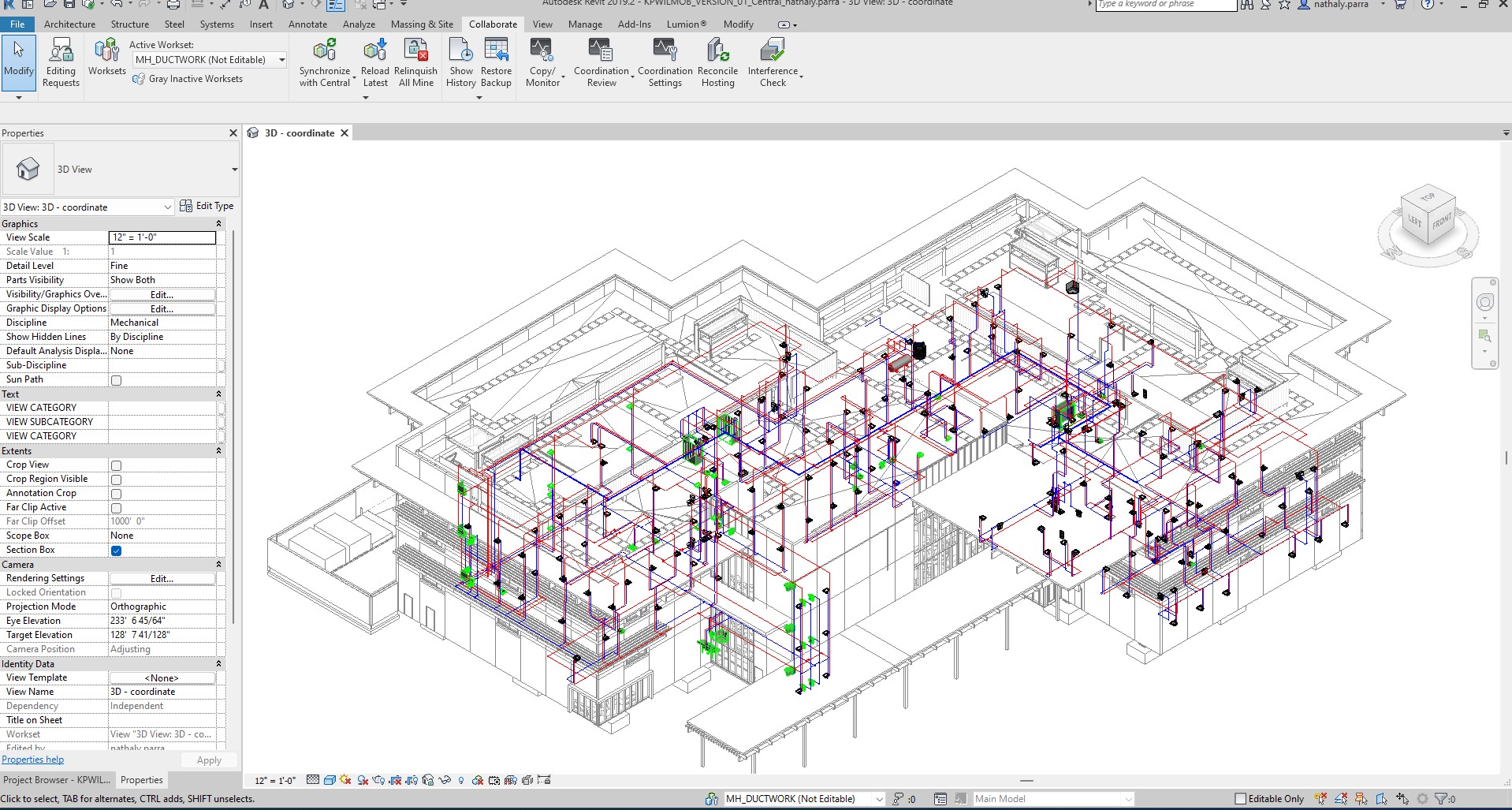
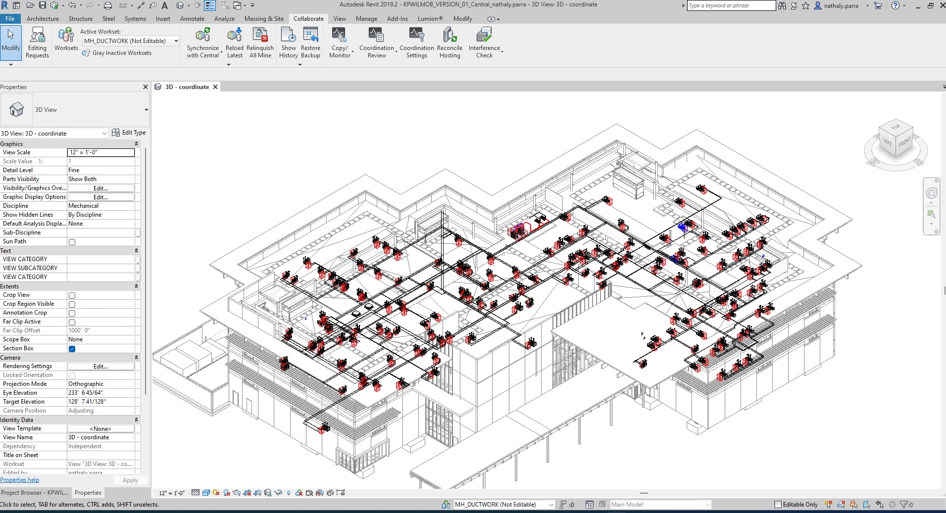
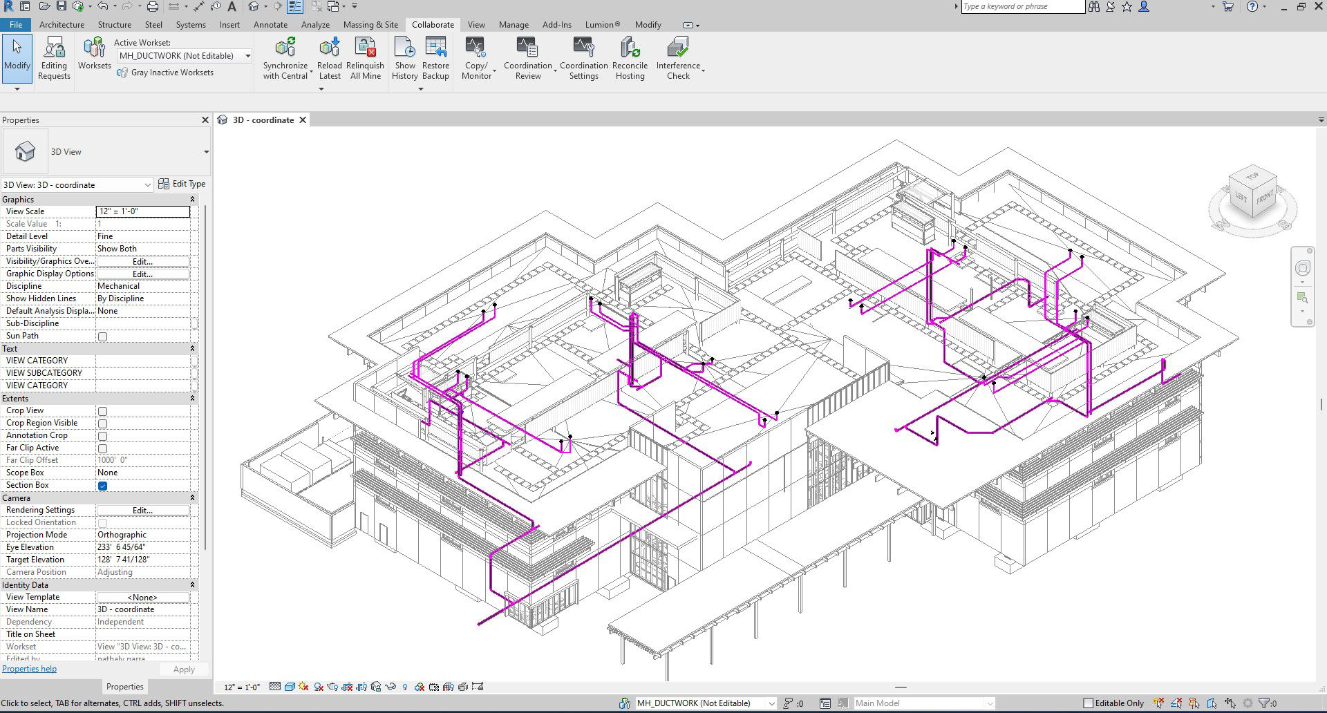
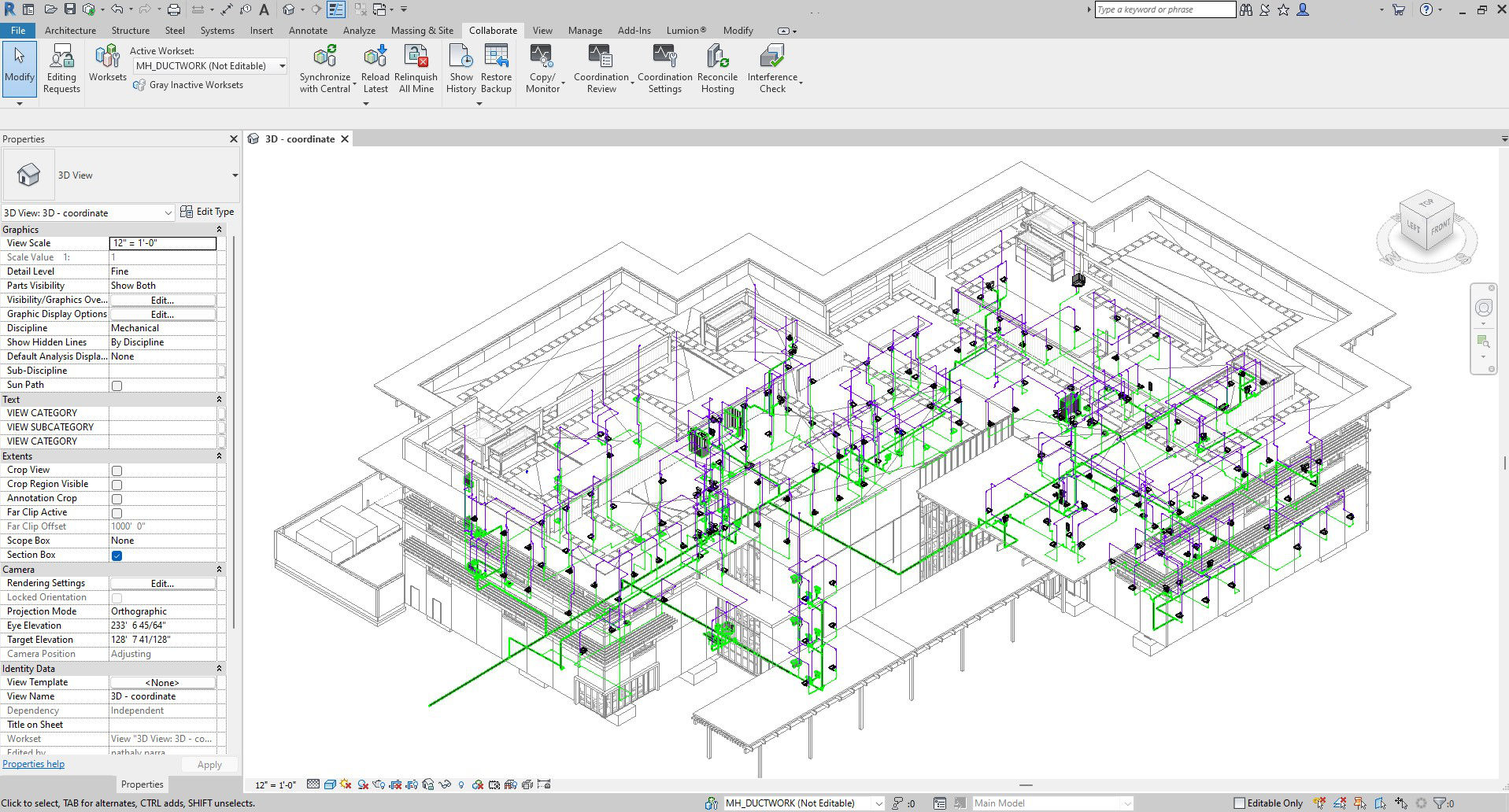
With our AI design assistant, BIMEP, you can have a complex MEP system in Autodesk Revit in less time.
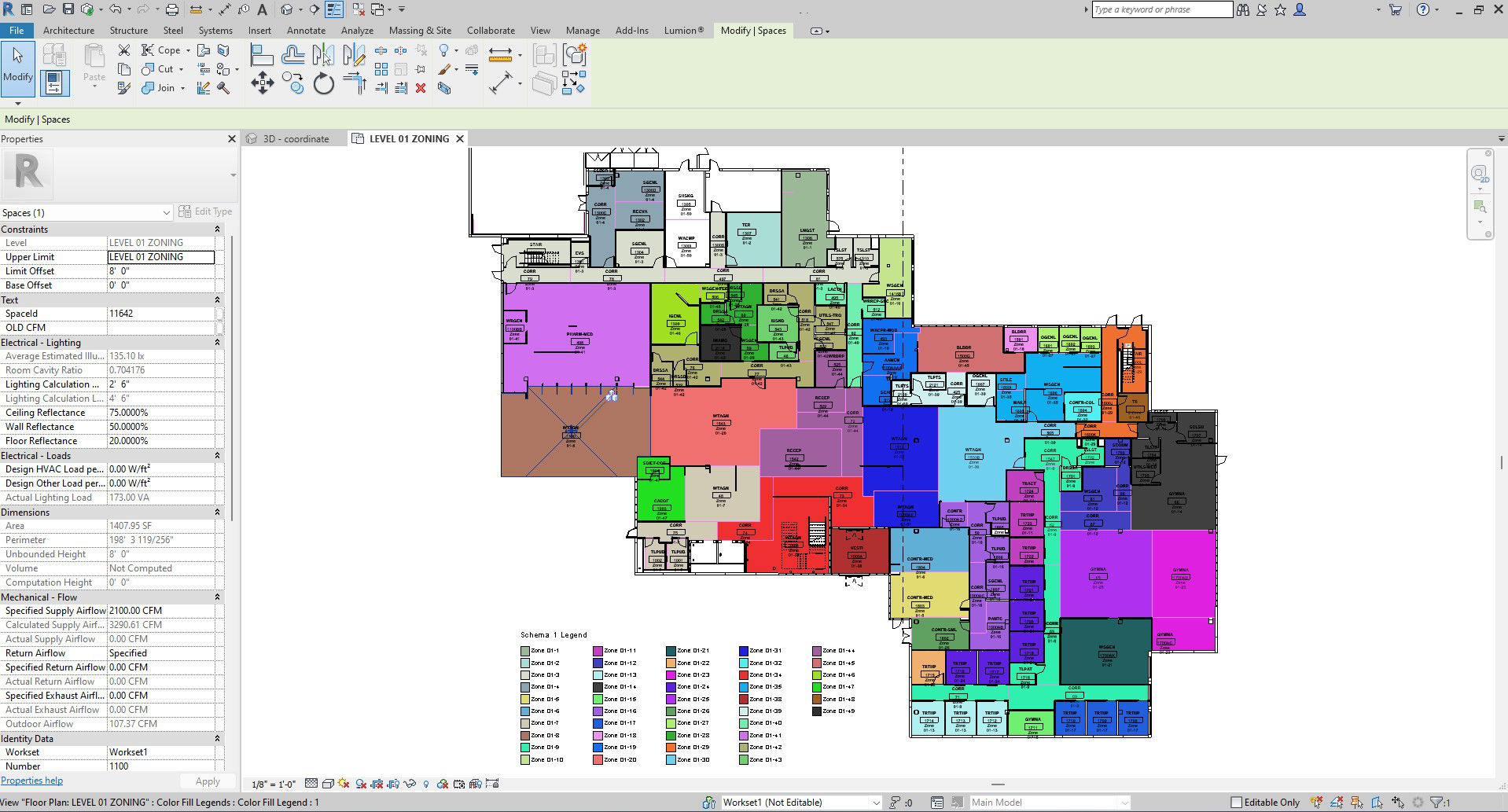
Zoning
Plumbing
Equipment plotting
Electrical
Ductwork
An application that allows you to navigate in a fully 3D environment and access different monitoring and administration tools, bringing together the asset management of the facilities, system supervision, documentation, management services, alerts and analysis that will be decisive in each process
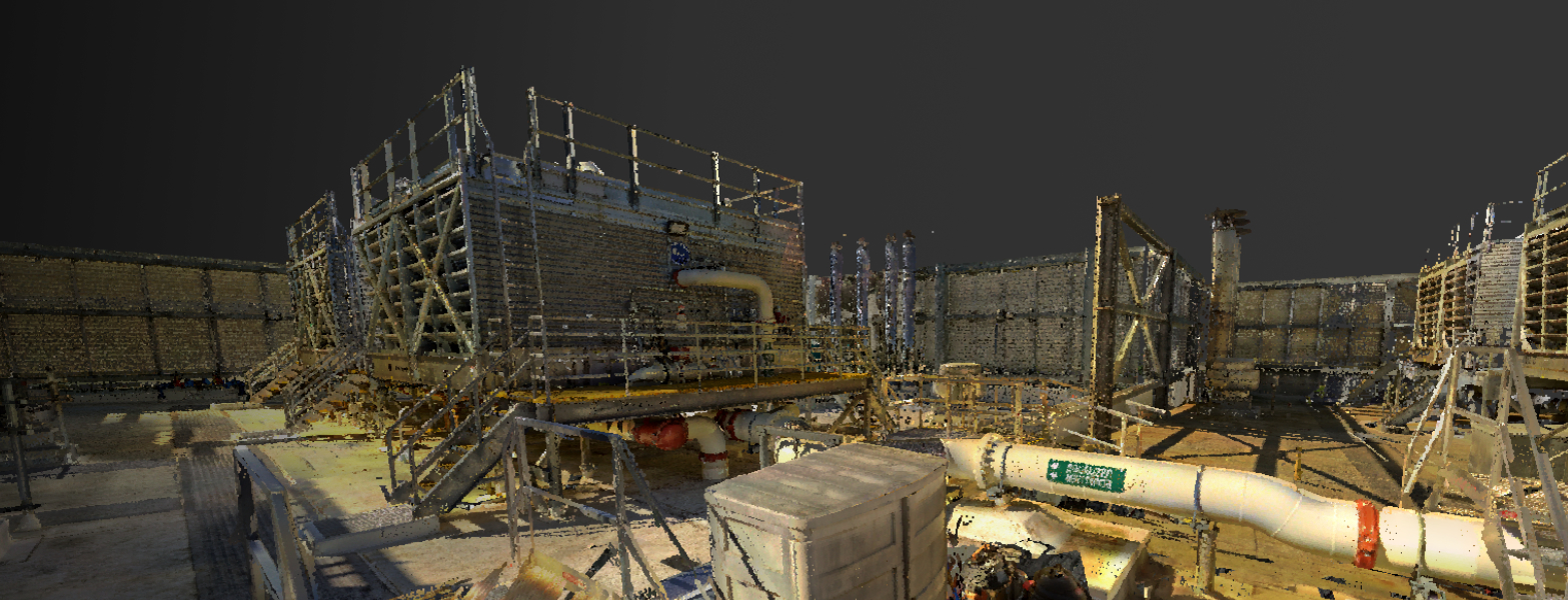
LiDAR stands for Light Detection and Ranging and is very similar to the better-known Radar. Basically, a laser pulse is sent out of a transmitter and the light particles (photons) are scattered back to the receiver.
See More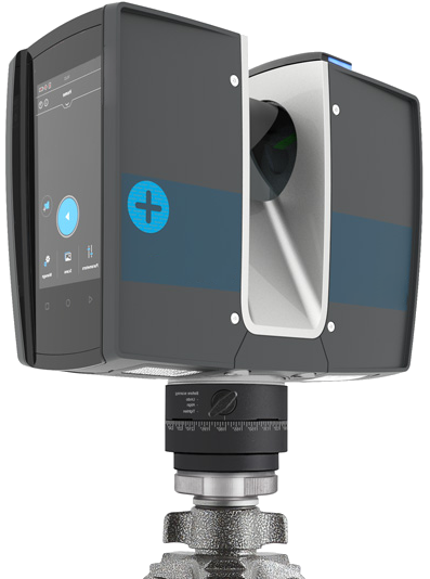
A visual way to follow construction progress. Reporting with colors, photography and 360 videos.
See More
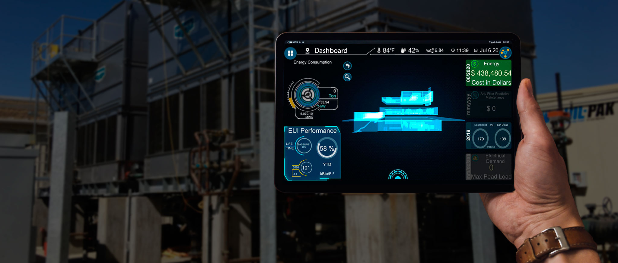
3DVES has developed an energy dashboard that uses state-of-the-art reporting to monitor energy KPIs in real-time with the help of an interactive interface.
See More
|
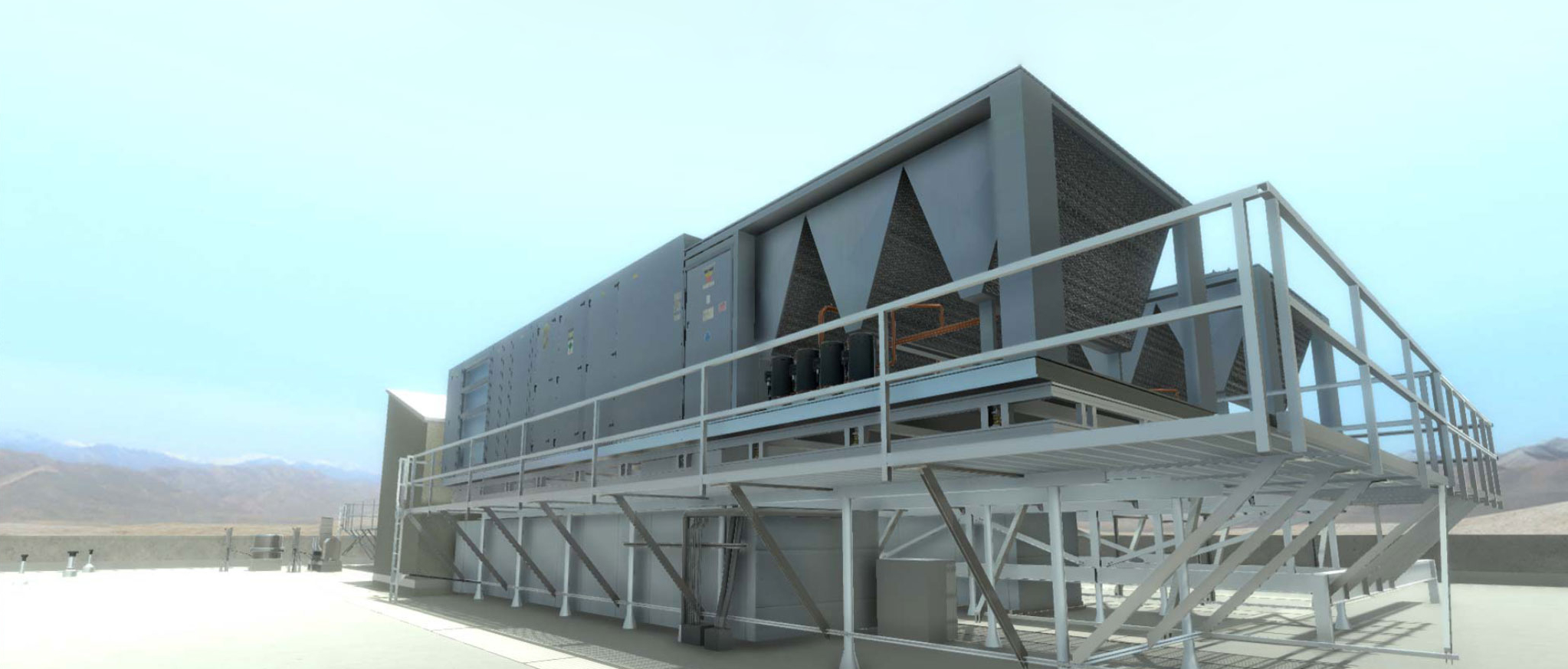
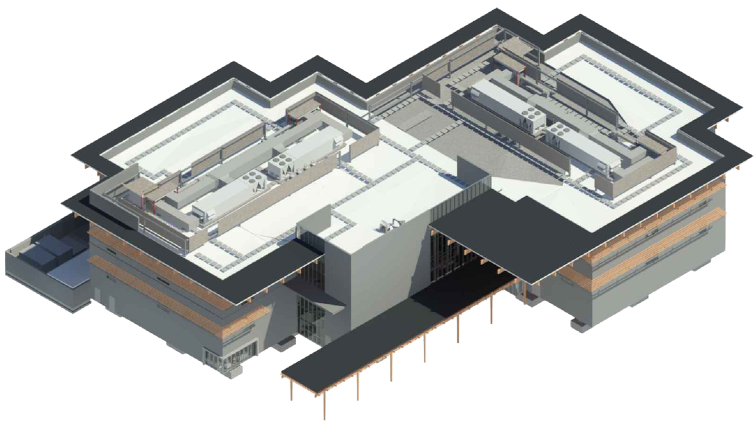
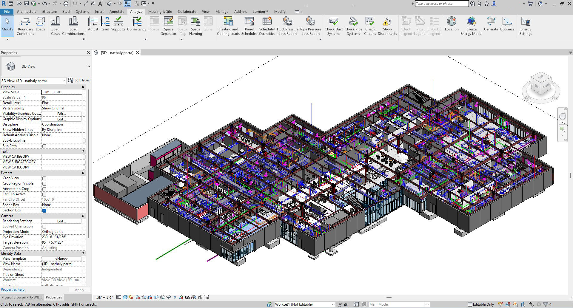
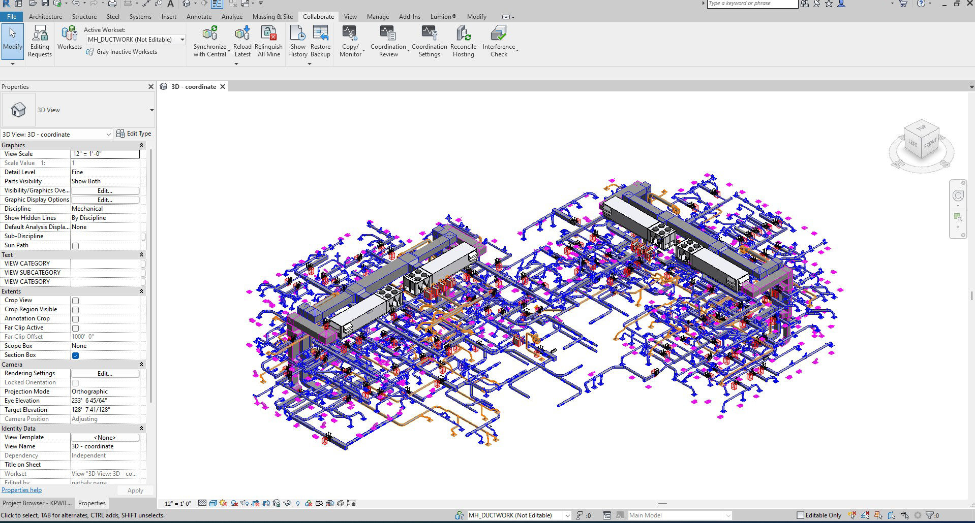
Revit models
We create detailed Revit models of plumbing, drainage, and water systems for complex facilities. Our models accurately reflect real installations, following local building codes and engineering standards to ensure coordination, precision, and constructability. We specialize in as-built documentation and BIM modeling, delivering high-quality digital representations that support design, maintenance, and future expansion of building systems. |
 |
Architectural Model
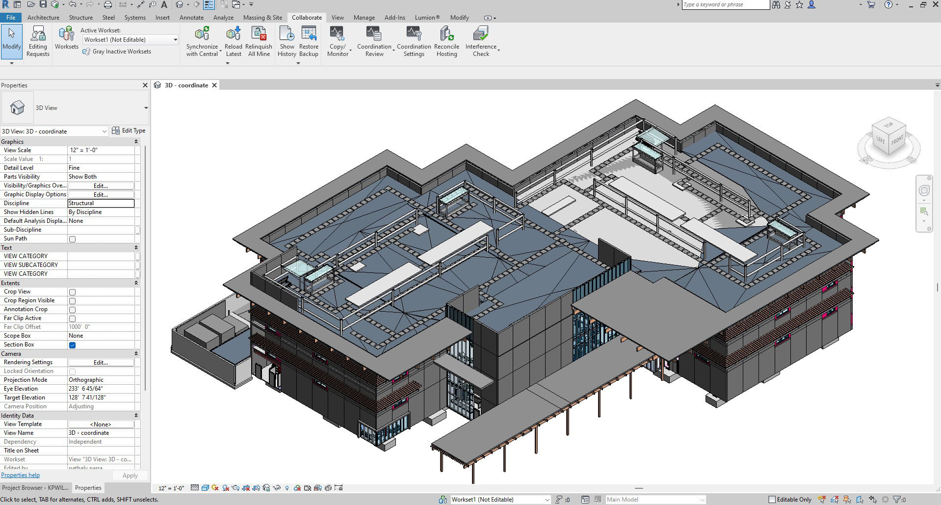
Coordination Model
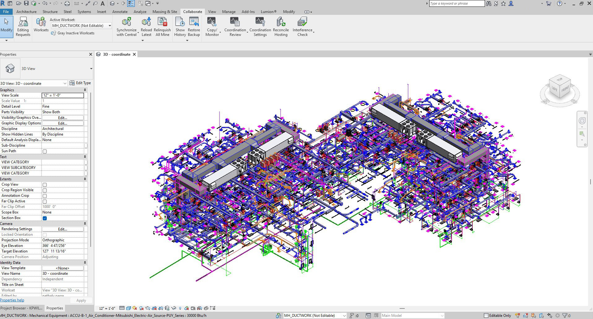
Ductwork System
Domestic System
Hidronic System
Storm Drain
Waste and Vent System
Mechanical Zoning
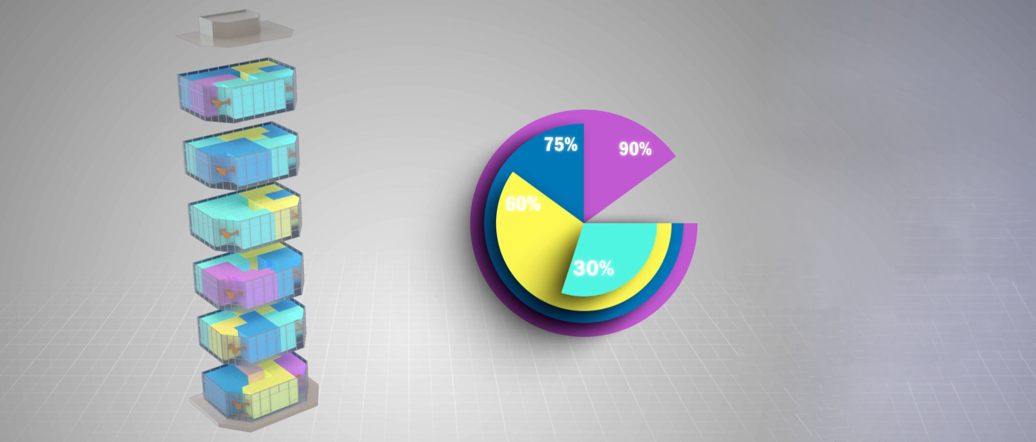
Web based platform that analyzes a BIM model to support the best decisions for your building project.
Generate graphs based on the BIM's information, and classify them by rules and needs.
Before uploading the BIM model, enter the parameters on which the project will be based, this will help with quality control and validating information from the BIM.
Watch how to do it.
Video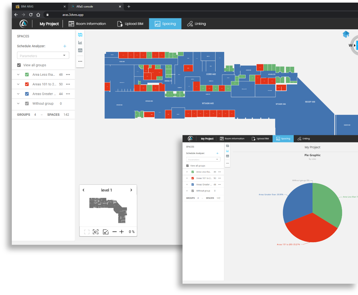
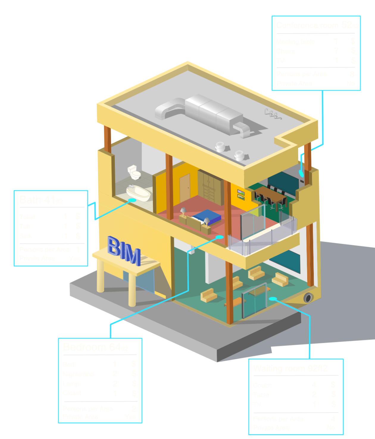
BIMEP extracts the spaces and information directly from the Revit file.
Then you can classify the information, grouping it by rules established by project members.
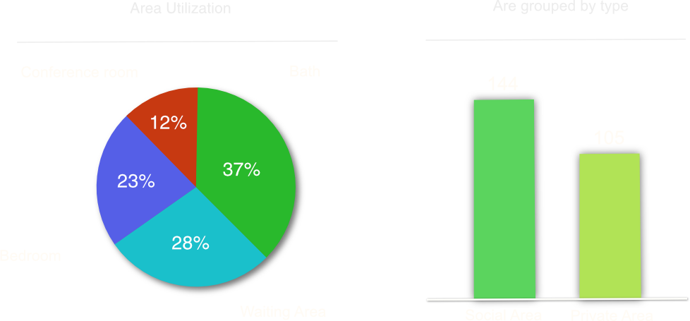
Then visualize them through graphs.
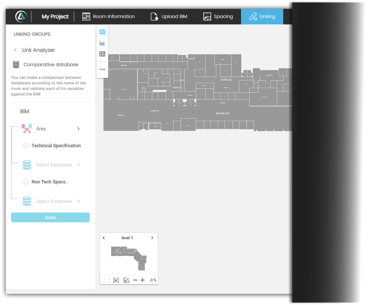
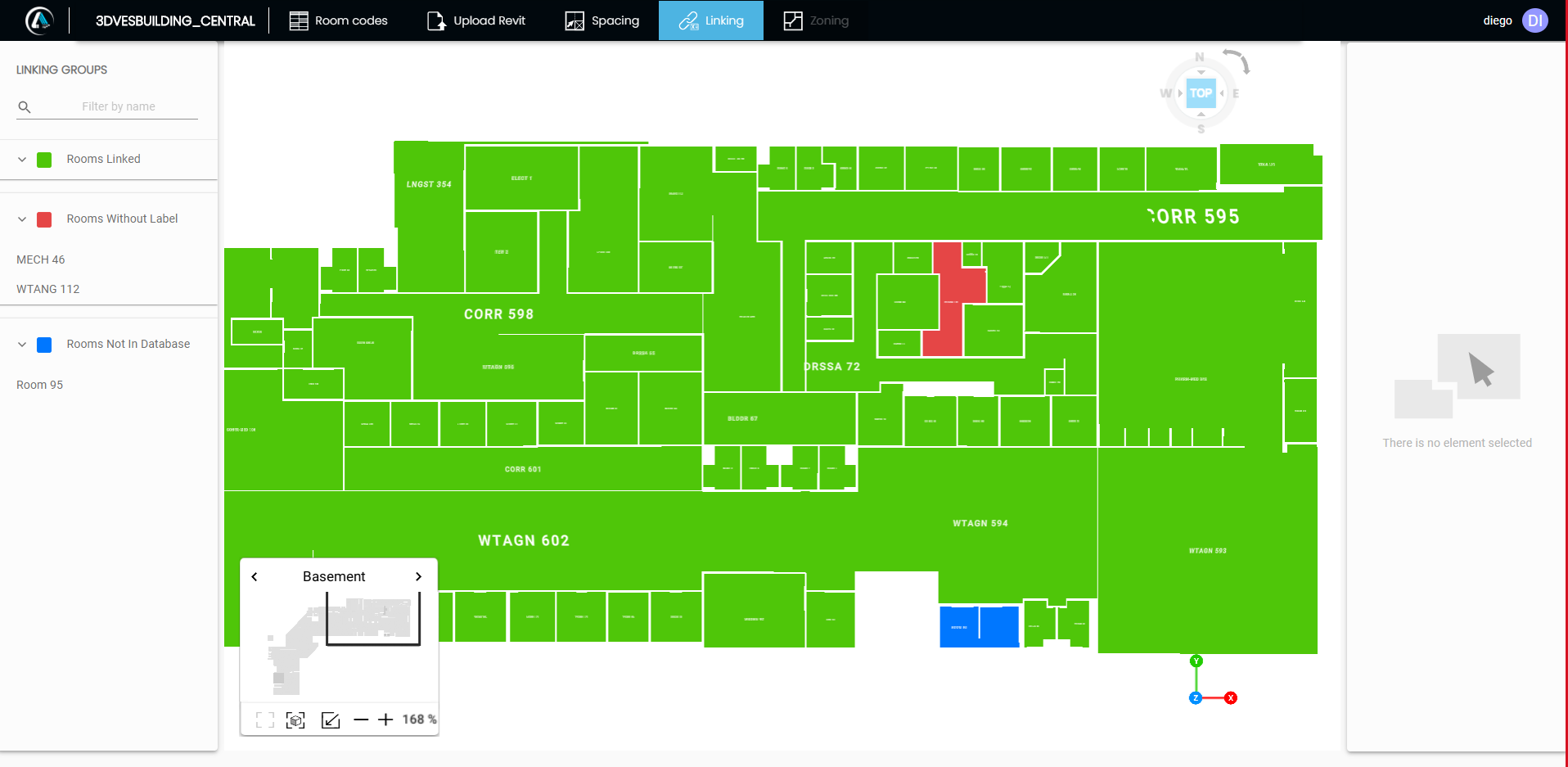
Linking allows you to compare the original requirements against the professional design, thereby validating non-technical, technical, and BIM information.
A key objective of BIMEP is to empower stakeholders to intuitively play and evaluate a BIM. Further, it promotes teamwork by allowing project participants to analyze, assess and share information about the spaces in the BIM.
Owners, architects, engineers, designers, project administrators and construction professionals are among the key stakeholders who can benefit from BIMEP.
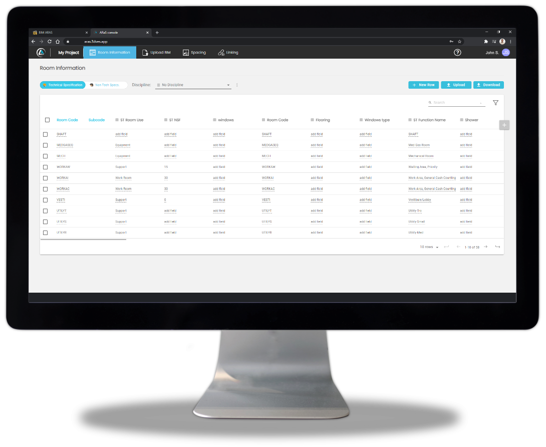
If you work with 3D or BIM technologies, you are familiar with the challenges for interacting with it. Such as: performing statistical analysis, running what-if scenarios, or searching for specific criteria, then you need to know about BIM ARAS.
BIM ARAS, is a tool designed to analyze a BIM, providing functionality to calculate things like BIM compliance with project scope, validating technical characteristics, perform cost estimates, and monitor QA and QC.

A key objective of BIM ARAS is to empower stakeholders to intuitively play and evaluate a BIM. Additionally, it promotes teamwork, by allowing project participants to analyze, evaluate and share information about the spaces in the BIM.
Owners, Architects, Engineers, Designers, Project Administrators and Construction Professionals, are among the key stakeholders who will benefit from BIM ARAS.
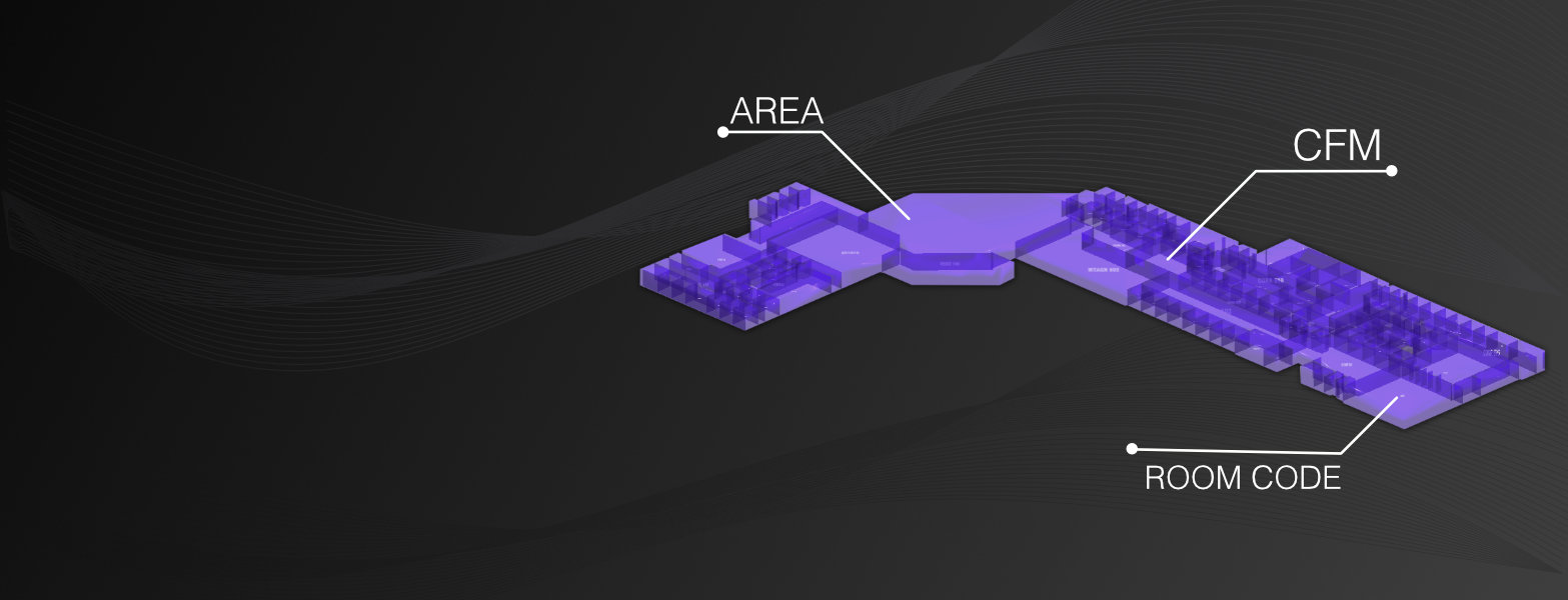
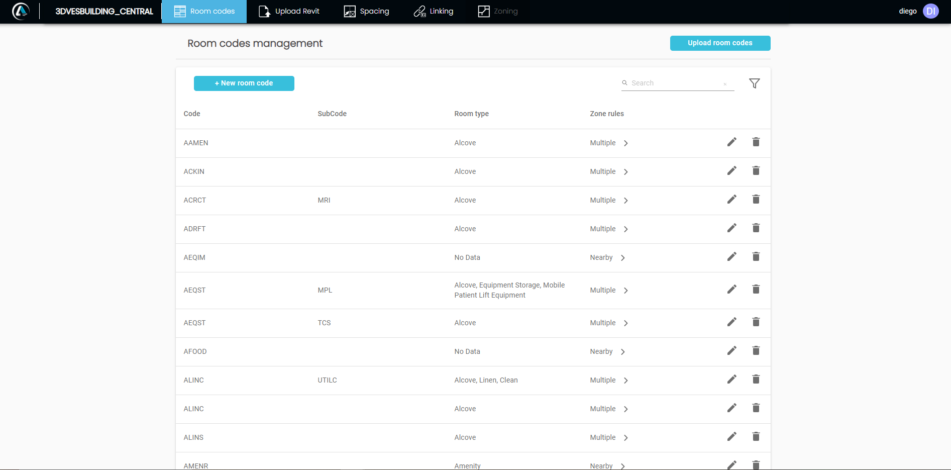
- Room Codes is a process by which spaces and rooms are defined in BIM ARAS.
- With BIM ARAS you can edit and delete room codes.
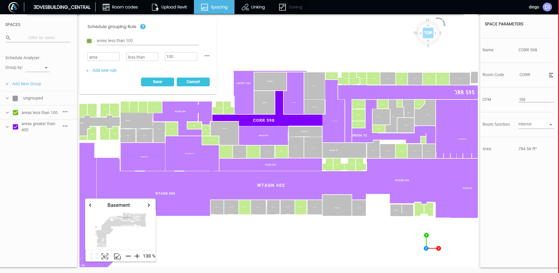
- The spacing module is highly interactive, allowing the user to perform distinct types of space analysis. Create parameter-based rules like area, CFM, and others...
- The user can also generate Group Reports.
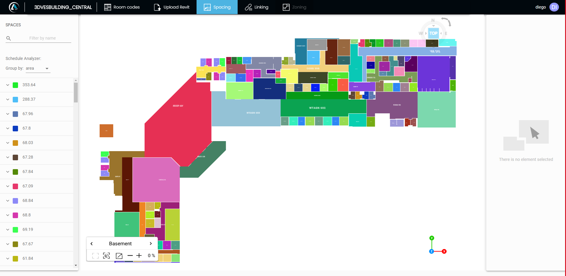
The Spacing Module supports filter and the flexibility to modify the Room Code parameters of a space, such as cfm, or Room function.
- The user can perform quick group analysis based on selected parameters and see the results of these edits in real time.
- Using the uploaded BIM, the user can perform QA and QC validations between the BIM Specifications Database, the Project Technical Specifications established in BIM ARAS, and other specifications.

Lidar is an active optical sensor that transmits laser beams toward a target while moving through specific survey routes.
Laser scanning allows for the virtualization of a project with total precision, since its high level of detail gives the user the experience of moving from place to place while remaining stationary.
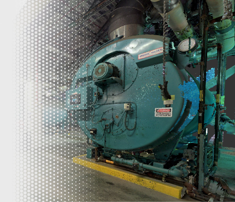
The Lidar scanner generates an accurate point cloud file, providing the user with high resolution details that complement the entire process with 360 photos and videos, offering visual and specific reports on a given topic.
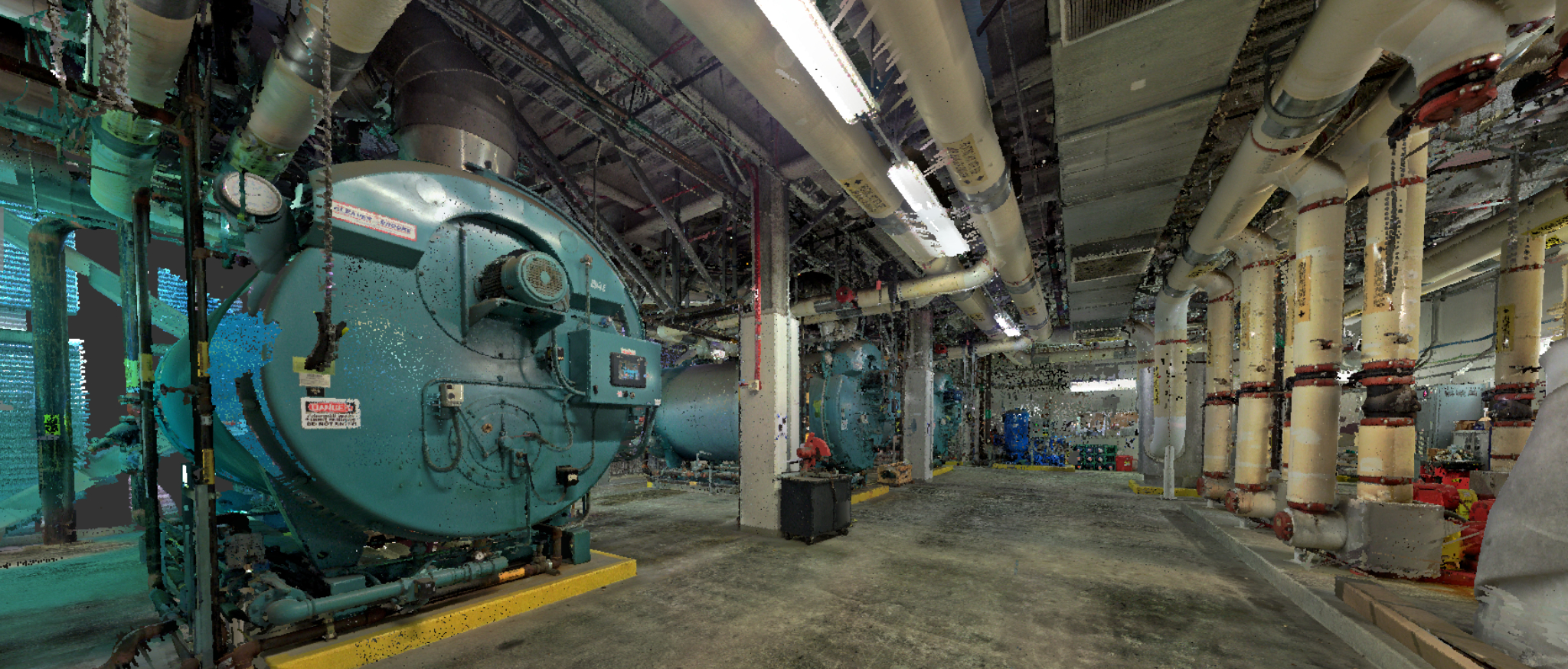
With LiDAR technology, you can create accurate simulations of different facilities without the need to be physically on-site.
This streamlines planning times and significantly reduces costs in the process.
PointCloud